search
France climate map
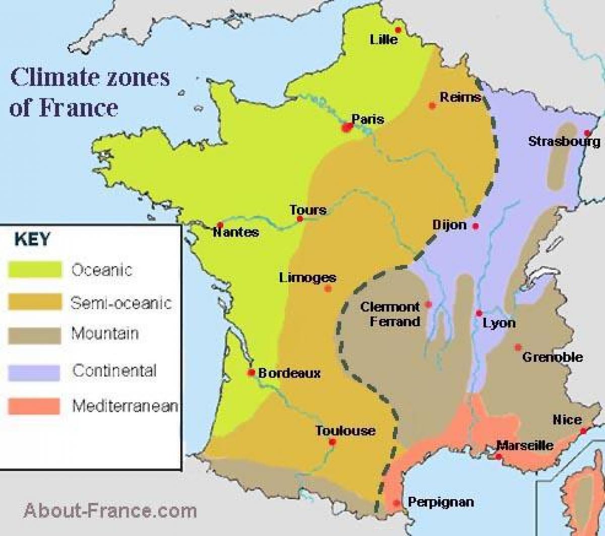
Map of France climate. France climate map (Western Europe - Europe) to print. France climate map (Western Europe - Europe) to download. France has a mostly temperate climate, although there are many regional differences. The north and northwest have a temperate climate, while a combination of maritime influences, latitude and altitude produce a varied climate in the rest of Metropolitan France. In the south-east a Mediterranean climate prevails as its shown in France climate map. In the west, the climate is predominantly oceanic with a high level of rainfall, mild winters and cool to warm summers. Inland the climate becomes more continental with hot, stormy summers, colder winters and less rain. The climate of the Alps and other mountainous regions is mainly alpine, with the number of days with temperatures below freezing over 150 per year and snow cover lasting for up to six months.
France generally enjoys cool winters and mild summers except along the Mediterranean where mild winters and hot summers are the norm. For the most warmth and sunshine go to the south of the country as its mentioned in France climate map. The Provence and Languedoc regions are characterized by mild winters and blisteringly hot summers. Along the north and central regions, Paris has cool and fairly rainy winters, though summers here are usually hot.
Winters are a lot colder in the eastern regions of Alsace-Lorraine and in the mountainous regions of the Alps, the Pyrénées, and the Massif Central as you can see in France climate map. As you travel south along the Atlantic Coast the weather gets milder and more pleasant. Spring rainfall is still plentiful, but summers are more likely to be warm and dry. Here sunny days are plentiful throughout the fall. Farther east, toward the Alsace region, the country enjoys a drier, sunnier climate, but winters can be very cold. In the Massif Central the climate is harsh and cold.


