search
Medieval France map
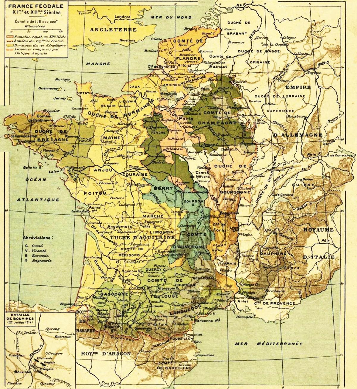
Map of France medieval. Medieval France map (Western Europe - Europe) to print. Medieval France map (Western Europe - Europe) to download. From the beginning of the X century, the political landscape of the French domain was dominated by princes as its shown in the medieval France map. Around the year one thousand, the hierarchy of powers malfunctioned and the royal authority was no longer in a position to defend subjects locally. The latter turned to the counts and viscounts, the dukes and the marquis, and the king magistracy became essentially moral, insufficient to prevent the system of local clienteles from consolidating. The XI century will be that of the lords, the kings trying to contain the excesses of the system, in the middle of the bursting of sovereignty into a multitude of independent principalities. In the XII century, Louis VI, from the beginning of his reign, will deal the first blows to the feudal system by encouraging communal powers, using them as a royal lever against the power of the vassals; the Crusades, likewise, will force the lords to commit their powers to the crown.
In the XIIIth century, from Philip Augustus to Philip the Fair, the progress of the royal power will succeed in reimposing a central government as its mentioned in the medieval France map. The king requires the homage of his vassals, intervenes in the fiefdoms, tax of felony his undisciplined vassals, plays for himself feelings of fidelity which must be attached to the person of the lord. A feudal monarchy is then set up, using vassalic obligations to bend principalities and territorial lords. By force of arms, by judgments, purchases, games of succession, the sovereigns will gather the largest possible number of fiefdoms to the royal domain, dismembering the privileges of the feudal lords.
The appearance of royal suzerainty, which essentially marked the reign of Louis VII, allowed his son Philippe Auguste (1180-1223) to increase his estate tenfold: inheritance of Picardy, or, more exactly, of several Picardy counties and châtellenies (Treaty of Boves, 1185) and, above all, annexation of the possessions of the Plantagenets from 1203 to 1205 (→ Normandy, Maine, Anjou, Touraine, Poitou, etc.) as you can see in the medieval France map.


