
search
France agriculture map
Map of France agriculture. France agriculture map (Western Europe - Europe) to print. France agriculture map (Western Europe - Europe) to download. France is the European Union leading agricultural producer, accounting for about one-third of all agricultural land within the EU. Northern France is characterized by large wheat farms as its shown in France agriculture map. Dairy products, pork, poultry, and apple production are concentrated in the western region. Beef production is located in central France, while the production of fruits, vegetables, and wine ranges from central to southern France. France is a large producer of many agricultural products and is currently expanding its forestry and fishery industries. The implementation of the Common Agricultural Policy (CAP) and the Uruguay Round of the General Agreement on Tariffs and Trade (GATT) have resulted in reforms in the agricultural sector of the economy.
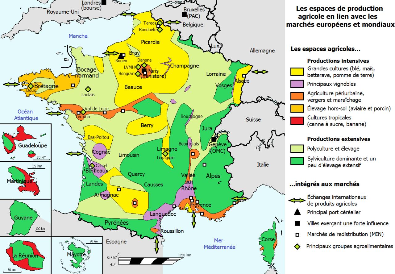
France is the world sixth-largest agricultural producer and the second-largest agricultural exporter, after the United States. However, the destination of 70% of its exports are other EU member states and many poor African countries (including its former colonies) which face serious food shortage. Wheat, beef, pork, poultry, and dairy products are the principal exports as its mentioned in France agriculture map. The United States, although the second-largest exporter to France, faces stiff competition from domestic production, other EU member states, and third world countries. U.S. agricultural exports to France, totalling some $600 million annually, consist primarily of soybeans and products, feeds and fodders, seafood, and consumer oriented products, especially snack foods and nuts. French exports to the United States are mainly cheese, processed products and wine.