search
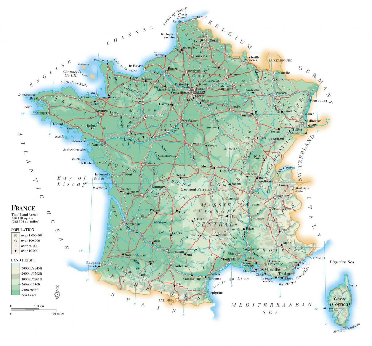
France geographic map
Geographical map of France. France geographic map (Western Europe - Europe) to print. France geographic map (Western Europe - Europe) to download. France is a country located primarily in Western Europe, but containing territory in South America, the Caribbean, and the Indian Ocean, as well as numerous territories of various status as its shown in France geographic map. In Europe France borders the Atlantic Ocean and the Mediterranean. To the west is the Bay of Biscay, to the north is the English Channel.
France total area is 674,843 km2 (Whole territory of the French Republic, including all the overseas departments and territories, but excluding the disputed French territory of Terre Adélie in Antarctica) as its mentioned in France geographic map. Its terrain is mostly flat plains or gently rolling hills in north and west.
Metropolitan France is located in Western Europe, the French Republic also has a number of territories in North America, the Caribbean, South America, the southern Indian Ocean, the Pacific Ocean, and Antarctica. These territories as you can see in France geographic map have varying forms of government ranging from overseas department to overseas collectivity. France overseas departments and collectivities share land borders with Brazil, and Suriname (bordering French Guiana), and Sint Maarten (bordering Saint-Martin).


