search
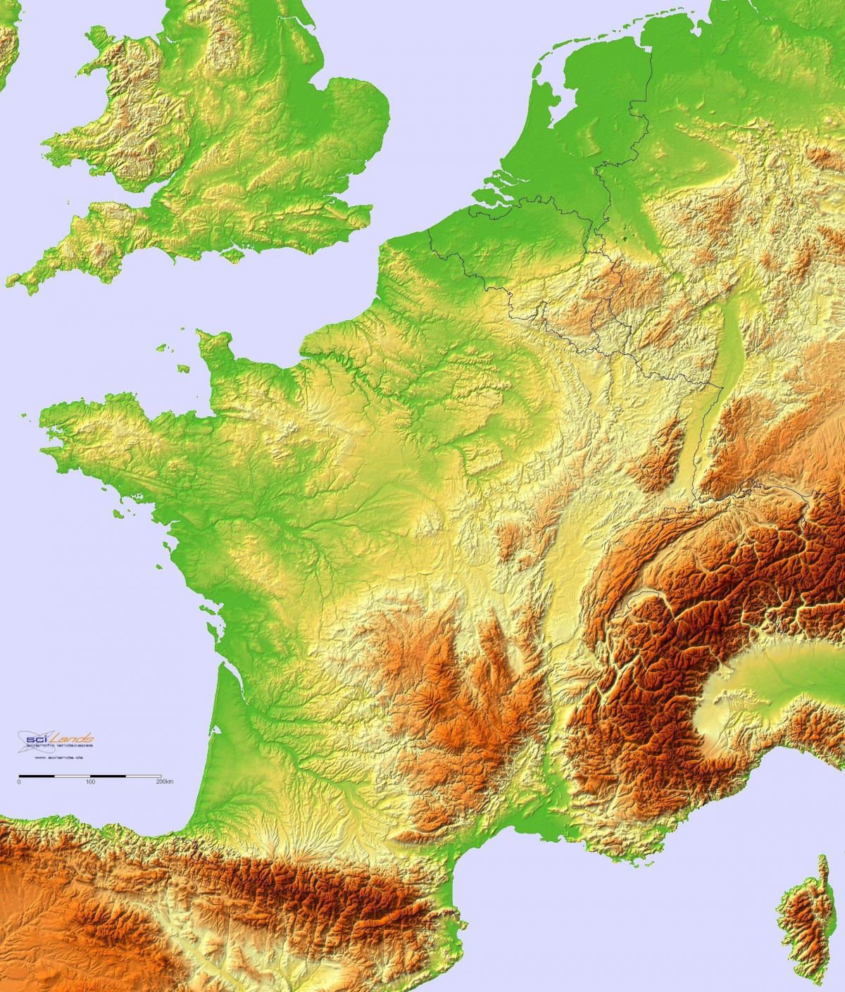
France topographic map
Map of France topographic. France topographic map (Western Europe - Europe) to print. France topographic map (Western Europe - Europe) to download. The highest point in France is Le Mont Blanc, whose summit is at 4,810.45 m (15,782 ft) above sea level as its shown in France topographic map. Le Mont Blanc lies on the border between France and Italy, just south of Switzerland, and is also the highest peak in Europe. The second highest mountain range in France is the chain of the Pyrenees, on the Spanish border. The largest mountain area wholly in France is the Massif Central: this area covers several contiguous areas of mountain, including the Monts d'Auvergne, the Monts du Forez, the Cévennes, the Aubrac, the Causses and the Montagne Noire.
France topographically is one of the most varied countries of Europe, with elevations ranging from sea level to the highest peak of the continent, Mont Blanc (4,807 m/15,771 ft), on the border with Italy. Much of the country is ringed with mountains. In the northeast is the Ardennes Plateau, which extends into Belgium and Luxembourg; to the east are the Vosges, the high Alps, and the Jura Mountains; and along the Spanish border are the Pyrenees, much like the Alps in ruggedness and height as its mentioned in France topographic map.
The core of France is the Paris Basin, connected in the southwest with the lowland of Aquitaine. Low hills cover much of Brittany and Normandy as you can see in France topographic map. The old, worn-down upland of the Massif Central, topped by extinct volcanoes, occupies the south-central area. The valley of the Rhône (813 km/505 mi), with that of its tributary the Saône (480 km/298 mi), provides an excellent passageway from the Paris Basin and eastern France to the Mediterranean. There are three other main river systems: the Seine (776 km/ 482 mi), draining into the English Channel; the Loire (1,020 km/ 634 mi), which flows through central France to the Atlantic; and the Garonne (575 km/357 mi), which flows across southern France to the Atlantic.


