
search
Tgv routes France map
Map of France tgv routes. Tgv routes France map (Western Europe - Europe) to print. Tgv routes France map (Western Europe - Europe) to download. The TGV is the fastest way to reach hundreds of destinations in France as its shown in tgv routes France map. TGV trains speed from Paris to major French cities including Bordeaux, Avignon, Lyon, Nantes and Nice. Operated by SNCF, the French national railway company, there are also inter-regional TGV services and direct TGV trains from France to a dozen cities in Germany and a handful of stations in Italy and Spain. Fast, double-decker TGV Europlex trains are used when travelling between Paris or Toulouse and Barcelona, while AVE S-100 trains run on the routes from Lyon and Marseille to Barcelona.
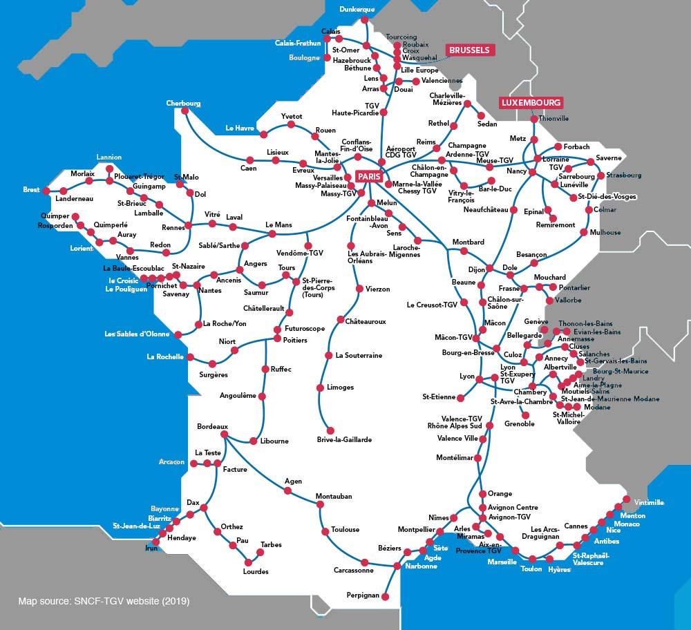
The domestic TGV routes can get you to every corner of France. In the north, there are international connections to Brussels in Belgium and Luxembourg as its mentioned in tgv routes France map. In the east, the TGV can take you to the German cities Frankfurt and Munich. If you travel south, you can take a direct train to Milan in Italy or Barcelona in Spain.
TGV Nord from Paris Gare du Nord. Connects to the north of France, to Lille, and Eurostar to London, Lille, and Brussels as you can see in tgv routes France map. TGV Est from Paris Gare de l’Est. Connects to the east of France, one of the new regions now called Grand Est, serving destinations like Reims, Metz (visit the great Pompidou Metz Museum), Nancy, Strasbourg, Luxembourg and beyond. TGV Sud-Est from Paris Gare de Lyon. Connects to the south and east of France. TGV Alpes from Paris Gare de Lyon. Connects to the east of France and in winter is particularly useful for skiers, going on to Alpine resorts like Courchevel. TGV Méditerranée from Paris Gare de Lyon. Connects to Provence and the Cote d'Azur. TGV Atlantique from Paris Gare Montparnasse. Connects to the south and the west of France.