search
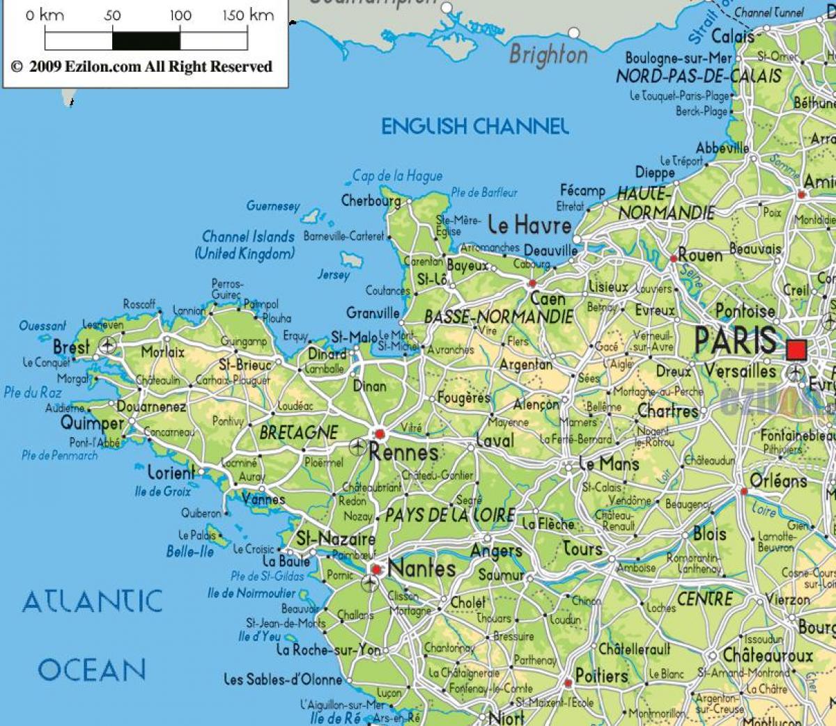
Map of north west France
Map of France north west. Map of north west France (Western Europe - Europe) to print. Map of north west France (Western Europe - Europe) to download. North West France is an area that includes Brittany in the west and Normandy in the east. It stretches down the Atlantic Coast via the Western Loire to the beaches of the Poitou Charentes as its shown in the map of north west France. Inland, the Loire Valley, Le Mans and Angers are included in this area. It is no surprise that the North West is a varied and interesting part of France with an interesting history, rich cultural heritage and fantastic wine and gastronomy to its name.
Easily accessible for visitors from the UK and from Northern Europe, North west France offers a variety of coastal and inland tourist destinations, with plenty of attractions as its mentioned in the map of north west France. Situated a couple of hundred miles south of the English Westcountry, this area of France is in many respects rather like a warmer sunnier version of the West of England. With less crowds, notably in the inland areas. The northwestern parts of France have a history that is deeply entwined with the history of the south of England, and there is a long tradition of migration and trade across the English Channel going back to long before Roman times.
The Pays de la Loire region is more generally thought of as being central western France as you can see in the map of north west France: but the Loire Atlantique department, or at least the parts of it on the north bank of the Loire, are strongly turned towards Brittany, and Nantes, capital of the Loire Atlantique, was once the capital of Brittany - a region to which it no longer belongs. Also the Mayenne department, in the north of the Pays de la Loire, juts up between Brittany and Normandy, which only actually share a short common border.


