
search
France road map
Detailed road map of France. France road map (Western Europe - Europe) to print. France road map (Western Europe - Europe) to download. Transportation in France relies on one of the densest networks in the world with 146 km of road and 6.2 km of rail lines per 100 km2 as its shown in France road map. It is built as a web with Paris at its center. France is believed to be the most car dependent country in Europe. In 2005, 937 billion vehicle kilometres were travelled in France (85% by car).
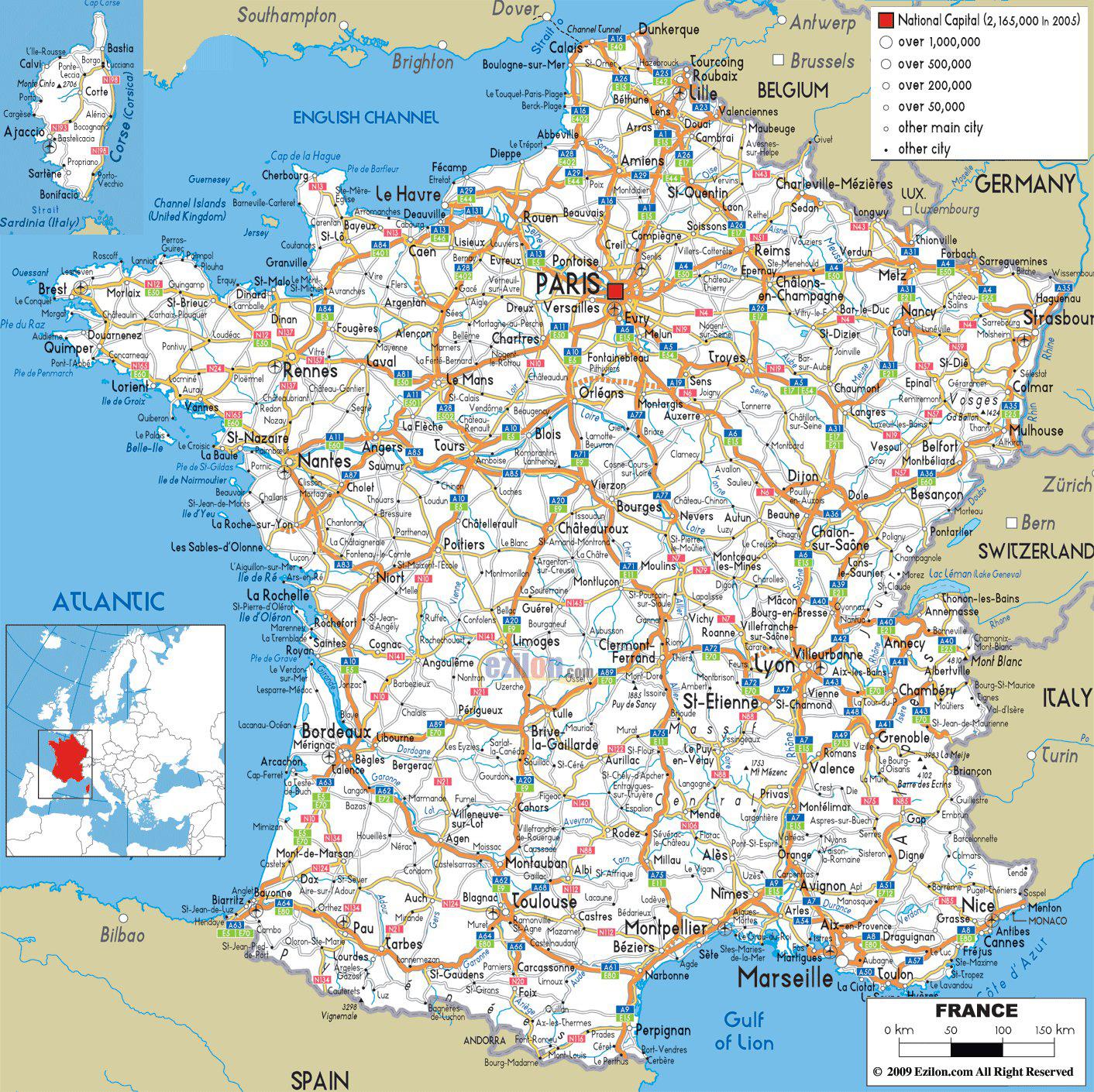
There are 1,000,960 km of roads in France as its mentioned in France road map. The French motorway network or autoroute system consists largely of toll roads, except around large cities and in parts of the north. It is a network totalling 12,000 km (7,500 mi) of motorways operated by private companies such as Sanef (Société des autoroutes du Nord et de l'Est de la France). It has the sixth largest highway network in the world, trailing only the United States, China, Canada, Spain and Germany.
France currently counts 30,500 km of major trunk roads or routes nationales and state-owned motorways as you can see in France road map. By way of comparison, the routes départementales cover a total distance of 365,000 km. The main trunk road network reflects the centralising tradition of France: the majority of them leave the gates of Paris. Indeed, trunk roads begin on the parvis of Notre-Dame of Paris at Kilometre Zero. To ensure an effective road network, new roads not serving Paris were created.
A roads (as in A6) are motorways, called autoroutes in France as its shown in France road map. N roads are national strategic truck routes. D roads are departmental (county) roads. They range from busy local routes and former national routes now downgraded (make sure you have an up-to-date map with the new road numbers) to tiny country lanes.