search
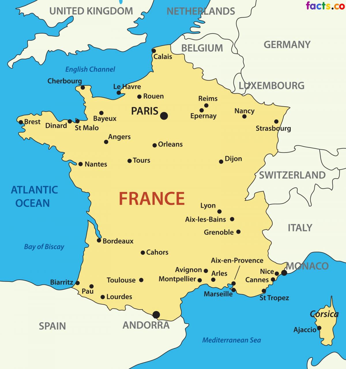
France country map
Map of France country. France country map (Western Europe - Europe) to print. France country map (Western Europe - Europe) to download. France is a country located in Western Europe. Clockwise from the north, France borders Belgium, Luxembourg and Germany to the northeast, Switzerland to the east, Italy to the south-east and Spain to the south-west, across the Pyrenees mountain range (the small country of Andorra lies in between the two countries) as its shown in France country map. The Mediterranean Sea lies to the south of France, with the Principality of Monaco forming a small enclave. To the west, France has a long Atlantic Ocean coastline, while to the north lies the English Channel, across which lies the last of France neighbours, England (part of the United Kingdom).
France country has been the world most popular tourist destination for over twenty years (81.9 million in 2007) and it is geographically one of the most diverse countries in Europe. Its cities contain some of the greatest treasures in Europe, its countryside is prosperous and well tended and it boasts dozens of major tourist attractions, like Paris, the French Riviera, the Atlantic beaches, the winter sport resorts of the French Alps, the castles of the Loire Valley, Brittany and Normandy as its mentioned in France country map. The country is renowned for its gastronomy (particularly wines and cheeses), history, culture and fashion.
Metropolitan France, or Mainland France, covers an area of 551,695 km²; it includes the island of Corsica as you can see in France country map. Compared, it is more than twice the size of the United Kingdom or more than twice the size of the U.S. state of Colorado. France has a total population of 67 million people (in 2020), 64.8 million inhabitants in Metropolitan France (the European part of France plus Corsica), and about 2.2 million in its overseas regions (French Guiana, Guadeloupe, Martinique, Mayotte, and Reunion). Other major dependencies are French Polynesia and New Caledonia.


