search
France high speed train map
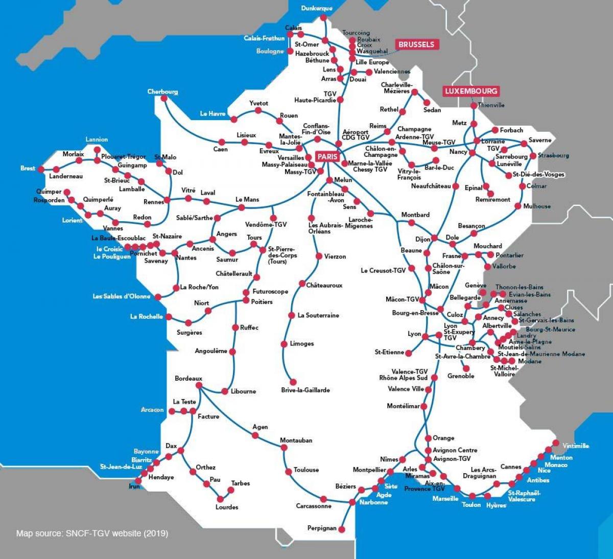
Map of France high speed train. France high speed train map (Western Europe - Europe) to print. France high speed train map (Western Europe - Europe) to download. At present, the rail network in France consists of some 2800 km (over 1600 miles) of dedicated high speed track, comprising four routes radiating out from Paris, and half of the "Rhine-Rhone route" as its shown in France high speed train map. However, an "interconnection" route round the south and west of Paris allows high speed connections between the routes, notably allowing north-south TGVs to avoid the centre of Paris.
TGV services operate to all the cities indicated on the map, and to many others too, since these high speed trains can also run - at reduced speed - on the traditional rail network as its mentioned in France high speed train map. This makes the TGV station at Lille Europe a very handy hub for passengers coming from the UK or Belgium and Holland. The alternative to changing at Lille is to take Eurostar to Paris, and then travel beyond Paris from the appropriate mainline terminus.; but this will normally involve changing terminus at Paris.
The latest new TGV lines as you can see in France high speed train map are as follow: Spring 2018 : Nimes / Montpellier bypass route, for trains between France and Spain. Summer 2017 : opening of almost 500 more kilometres of new high speed route, connecting Bordeaux and Rennes with Paris. 2016 Completion of Eastern TGV route from Paris to Strasbourg. Autumn 2013 : Direct TGV services now operating netween Paris and Barcelona. December 2011 saw the opening of the first 140 kilometres of the first transverseTGV line, the "LGV Rhin-Rhône", or Rhine-Rhone High Speed Line, linking Mulhouse and Dijon. This has greatly sped up rail links between Paris and Basel and Zurich, and between Germany, Strasbourg and the south of France. December 2010 saw the opening of 44 km of new high-speed line across the French-Spanish border, between Perpignan and Figueres.


