search
France temperature map
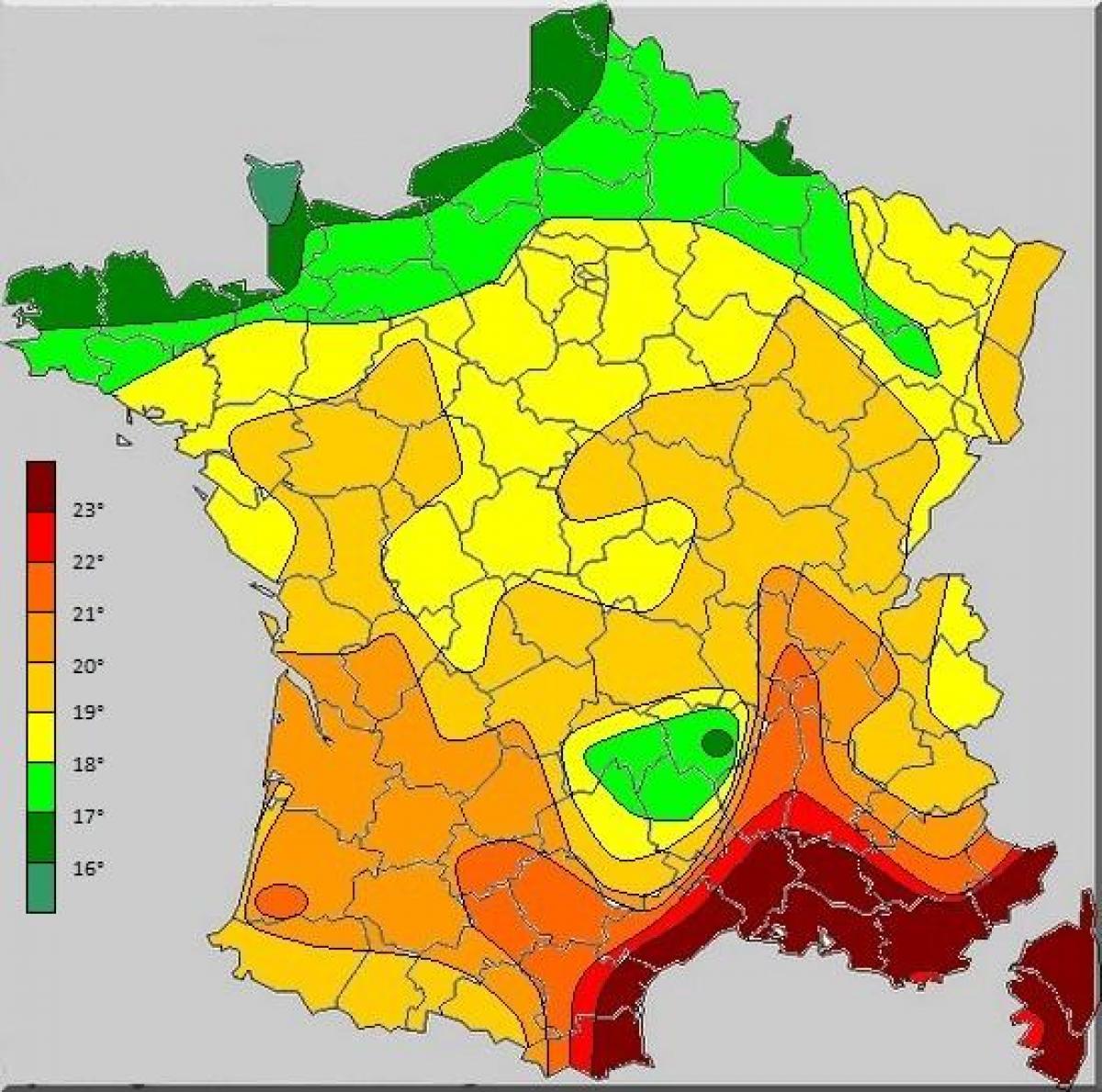
Map of France temperature. France temperature map (Western Europe - Europe) to print. France temperature map (Western Europe - Europe) to download. Average winter temperatures in France range from 32° F to 46° F and average summer temperatures from 61° F to 75° F as its shown in France temperature map. Bordering the Atlantic Ocean and the English Channel, western France has a temperate Atlantic climate, characterized by relatively mild winters (with average temperatures of 45° F). Brittany, in the far west, is the rainiest location of all, especially between October and November. Summers here aren’t overly hot either with the average temperature being 61° F. The amount of sunshine also varies widely: the sun shines for less than 1,600 hours a year in Brittany and the far north, for 1,660 hours in Paris, for about 2,000 hours in the center-south, and for more than 2,500 hours along the Mediterranean coast.
In the lowlands, the average temperatures in January range from 2 °C (35.5 °F) in the north-east (Lorraine and Alsace), to 4.5 °C (40 °F) in Paris, to 6.5 °C (43.5 °F) in Bordeaux, to 9 °C (48 °F) in Corsica and the French Riviera as its mentoned in France temperature map. The daily averages in July and August range from 17/18 °C (63/64 °F) along the English Channel coast, to 20 °C (68 °F) in Paris, to 24/25 °C (75/77 °F) along the Mediterranean coasts.


