search
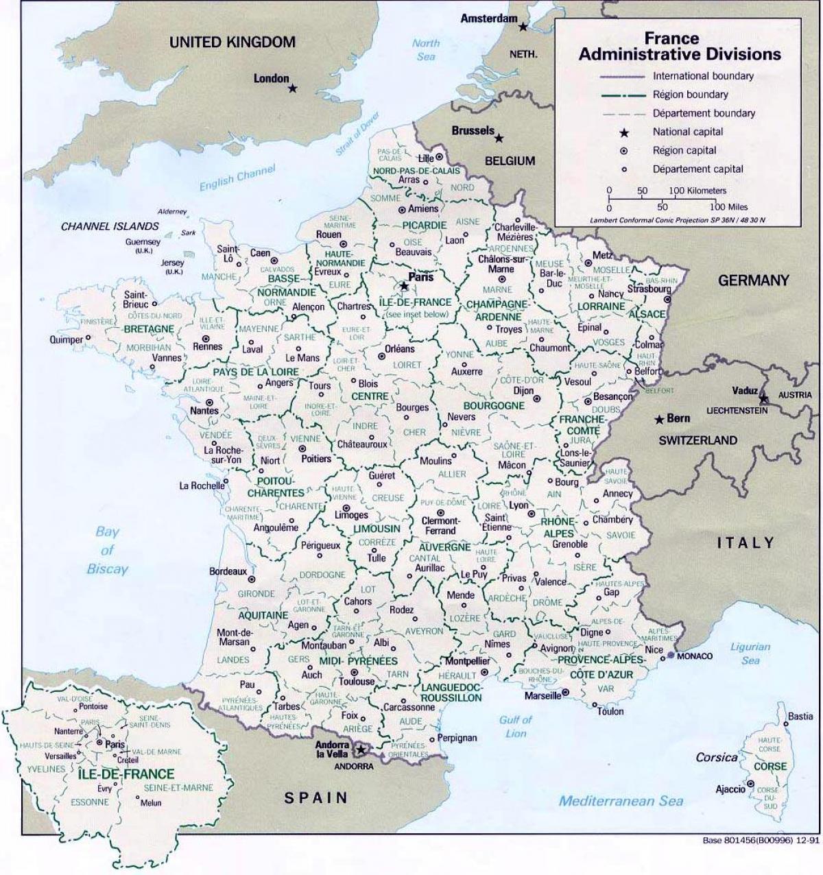
Map of France regions and cities
Map of France regions with cities. Map of France regions and cities (Western Europe - Europe) to print. Map of France regions and cities (Western Europe - Europe) to download. Much more than just Paris, France has a number of unbelievably beautiful cities that are waiting to be explored as its shown in the map of France regions and cities. History abounds throughout the land, and cathedrals, castles, culture and refined cuisine combine to entice you on a journey of discovery of all things French. The country is brimming with incredible destinations to discover, from the Flemish Lille in the north to the sulfurous Marseille on the Mediterranean coast.
Since 2016, Metropolitan France has been divided administratively into 13 regions; until 2015, there were 22 regions as its mentioned in the map of France regions and cities. The reduction has been obtained by merging certain regions together, as can be seen on the map above. Some of the new super-regions combine the names of the old regions, others like Occitanie or Grand Est are new. Meanwhile the old regions that have been merged are likely to keep their identities, though not their institutions, for some time to come, specially those that like Limousin, Champagne or Alsace, are historic provinces or areas of France.
Paris is the largest city and capital of France. The City of Paris has just 40 square miles of land with a population of 2.24 million in the city limits, and the most populous urban area in all of the European Union as you can see in the map of France regions and cities. The city proper has a density of over 21,000 people per square kilometer. The much larger Paris Region, with 4,638 square miles of land, has its own president and regional council with a population of 12 million. This accounts for 18% of France total population.


