
search
Mountains in France map
Mountain ranges in France map. Mountains in France map (Western Europe - Europe) to print. Mountains in France map (Western Europe - Europe) to download. There are two significant mountain ranges in France as its shown in mountains in France map, both of which form natural barriers used to create national boundaries. The Alps, the range where we find Mont Blanc, divide France and Italy in the southeastern corner of France. In the southwestern corner, the Pyrenees Mountains separate France from Spain. There are three other smaller mountain ranges in France. These are the extinct volcanoes of the Massif Central, the Jura Mountains at the border with Switzerland, and the Vosges Mountains near the German border.
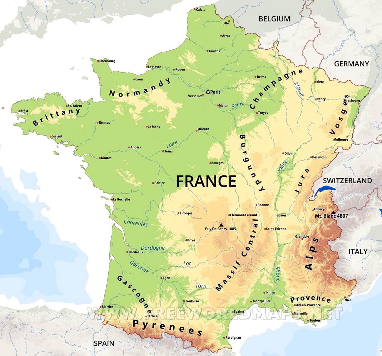
The French Alps are only a part of the great chain that extends across Europe, but they include its highest point, Mont Blanc (15,771 feet [4,807 metres]). These majestic mountains were formed in a series of foldings during Paleogene and Neogene times. They include the two greatest regions of permanent snow and glaciers in Europe. The Jura Mountains as its mentioned in mountains in France map, extending into Switzerland, are composed of folded limestone. The northeastern part of the Jura, which has the most pronounced folding, is in Switzerland. The highest point, however, is Mount Neige (5,636 feet [1,718 metres]), in France.
The Pyrenees, whose foothills shelter the picturesque Basque countryside, constitute the most ancient of the more recently formed mountains in France. They stretch for more than 280 miles (450 km), making a natural barrier between France and Spain as you can see in mountains in France map. The Vosges reaches its maximum elevation in the south, near the Alps, where crystalline rocks are exposed; the highest summits are called ballons, and the highest is the Ballon de Guebwiller (Mount Guebwiller), with an elevation of 4,669 feet (1,423 metres).